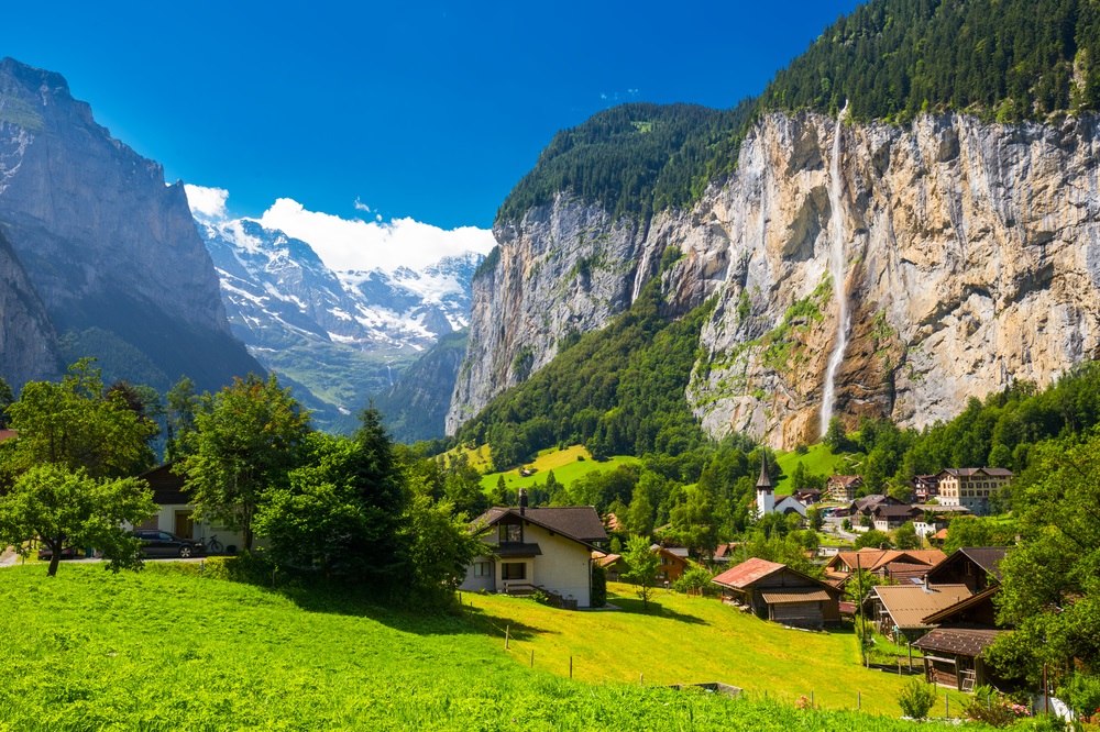
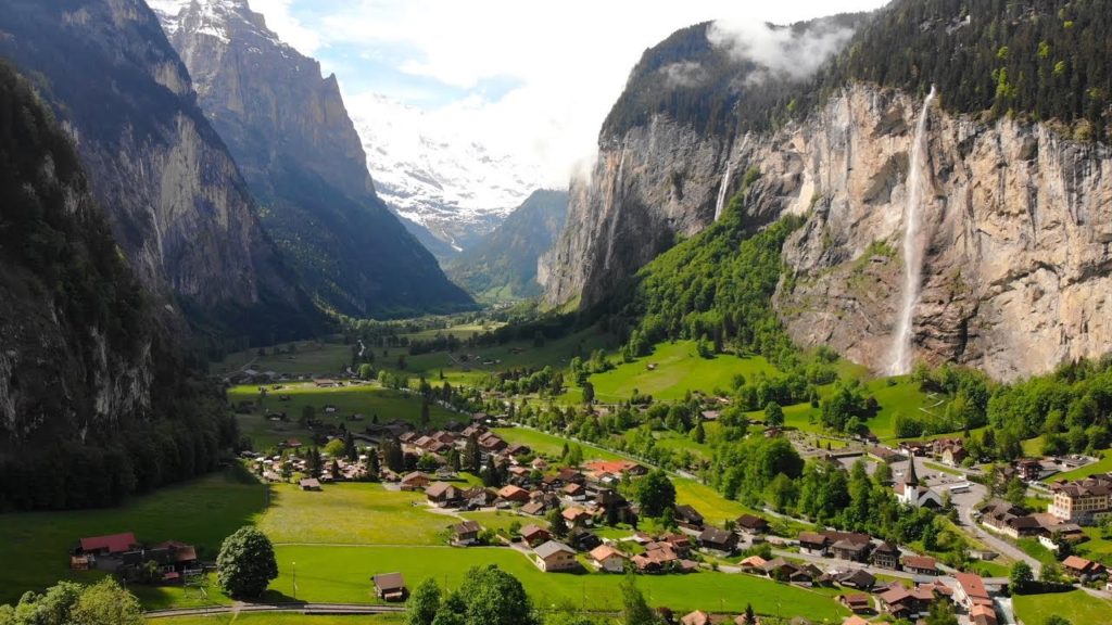
Lauterbrunnen is a municipality in the Swiss Alps. It encompasses the village of Lauterbrunnen, set in a valley featuring rocky cliffs and the roaring, 300m-high Staubbach Falls. Nearby, the glacial waters of Trümmelbach Falls gush through mountain crevices past viewing platforms. A cable car runs from Stechelberg village to Schilthorn mountain, for views over the Bernese Alps.
Lauterbrunnen was first mentioned in 1240 as “in claro fonte”, a Romance language place name meaning “clear spring”. By 1253 it was known to German speakers as Liuterbrunnon which by 1268 had the alternate spelling of Luterbrunnen. While the meaning of brunnen is undoubtedly spring or fountain, there is some dispute about the meaning of lauter: Some translate it as clear, clean or bright (which compares to the earlier Romance language meaning of the place mentioned above) while others translate it as “many” or “louder”. A local explanation is that the name Lauterbrunnen means “many springs” using a modern meaning of the word lauter in German: however this could be an example of a folk etymology.
Geography
Lauterbrunnen lies at the bottom of a U-shaped valley that extends south and then south-westwards from the village to meet the 8 kilometers (5.0 mi) Lauterbrunnen Wall. The Lauterbrunnen Valley (Lauterbrunnental) is one of the deepest in the Alpine chain when compared with the height of the mountains that rise directly on either side. It is a true cleft, rarely more than one kilometre in width, between limestones precipices, sometimes quite perpendicular, everywhere of extreme steepness.
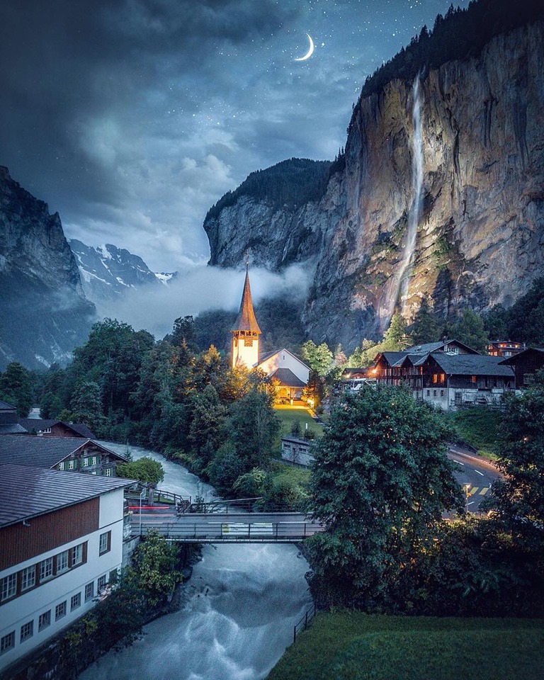
It is to this form of the valley that it owes the numerous waterfalls from which it derives its name. The streams descending from the adjoining mountains, on reaching the verge of the rocky walls of the valley, form cascades so high that they are almost lost in spray before they reach the level of the valley. The most famous of these are the Staubbach Fall, less than one kilometre from the village of Lauterbrunnen. The height of the cascade is between 800 and 900 feet (240 and 270 m), one of the highest in Europe formed of a single unbroken fall.
Climate
Between 1981 and 2010 Lauterbrunnen had an average of 136.5 days of rain or snow per year and on average received 1,207 mm (47.5 in) of precipitation.
The wettest month was July during which time Lauterbrunnen received an average of 144 mm (5.7 in) of rain or snow. During this month there was precipitation for an average of 13.8 days. The month with the most days of precipitation was June, with an average of 14.1, but with only 133 mm (5.2 in) of rain or snow. The driest month of the year was October with an average of 78 mm (3.1 in) of precipitation over 9.5 days.